INTAROS brings together expertise from a broad range of scientific disciplines to better understand the Arctic through a fully integrated Arctic Observing System. As part of this remit, INTAROS has always focused on the longer-term perspective and the future of Arctic observing. Every opportunity was taken to build capacity among young and early-career researchers, among high school students and the general public. Many classes, lectures and courses were offered throughout the project, as described in the report Scientific Capacity Building (Deliverable 7.11). Educational materials were provided for use with school groups and the general public, as described in the report Educational Materials V1 (Deliverable 7.7), and new learning modules were created for these groups, as described in the follow-up report Educational Materials V2 (Deliverable 7.8).
Educational Packages for Scientists (Deliverable 7.12), completes the capacity building process by providing the scientific educational materials used throughout the project in a format that facilitates independent learning and self-evaluation.
The set comprises four educational packages on the themes:
1. Terrestrial chemistry.
2. Seismology.
3. Ocean observations.
4. Snow and sea ice.
The packages are designed to be followed independently by users with an existing level of scientific knowledge, the requirement of which is specified for each package. Nevertheless, these packages are also likely to be of interest and benefit to members of the broader public, particularly those with an interest in life-long learning and further education.
1. E-Learning Module 1 - Terrestrial Biogeochemical Cycles
Contributor: Donatella Zona, U. Sheffield.
Learning Objectives: To introduce the response of carbon fluxes from arctic tundra ecosystems to global climate change. Students are expected to gain an understanding of the fate of the extensive soil carbon storage in the Arctic following climate change, to understand the cost of Arctic carbon emissions on society, to learn about the impact of emissions on local communities.
Target Audience: Upper division undergraduate students, graduate students (masters and PhD). A background in basic ecosystem ecology is recommended, but not required.
Content of the Package:
1. Tutorial: Global Change in Northern High Latitudes.
2. Supporting reading material.
3. Self-evaluation module.
1.1. Tutorial: Global Change in Northern High Latitudes
Temperatures in Northern latitudes have increased by 0.6 °C in the last 30 years, which is twice the global average with the largest increase in the non-summer seasons. Organic carbon in northern soils is more than double the current atmospheric pool. An increasing fraction of this organic carbon is vulnerable to be released to the atmosphere. This lecture summarizes the main impacts of climate change on arctic ecosystems, discussing the feedbacks occurring in the Arctic, and the implication for the global carbon balance. It also includes a discussion of the estimated cost of the increase in Arctic carbon emissions to our society and the consequences of recent changes for native communities.
1.2. Module 1: Supporting reading material.
Zona et al. 2016. Cold season emissions dominate the Arctic tundra methane budget. PNAS, 113:1, p.40-45. https://doi.org/10.1073/pnas.1516017113
Zona et al. 2022. Earlier snowmelt may lead to late season declines in plant productivity and carbon sequestration in Arctic tundra ecosystems. Sci Rep 12, 3986 (2022). https://doi.org/10.1038/s41598-022-07561-1
1.3. Module 1: Self-evaluation module.
Test your knowledge by taking the self-evaluation quiz.
2. E-Learning Module 2 - Seismology
Contributor: Mathilde Sørensen, UiB, and Peter Voss, GEUS.
Learning objectives: This package aims to introduce scientists to the use of ocean bottom seismometers (OBS) to understand natural hazards in the Arctic. Learners will gain an understanding of the OBS data available and will learn how to find and extract the data from the INTAROS database. They will also gain an understanding of the application of the INTAROS OBS data to analyse seismic events in the Arctic.
Target Audience: The audience for this video is mainly university students at bachelor or master level, but also researchers new to the field of seismological data.
Content of the Package:
1. Tutorial: Access, download and pre-processing of the INTAROS OBS data.
2. Tutorial: Examples on analysing seismic events recorded by the INTAROS OBS data.
3. Supporting reading material.
4. Self-evaluation module.
BONUS Tutorial: INTAROS Data Catalogue Demonstration
Christain Rønnevik from University of Bergen demonstrates how to access the INTAROS Data Catalogue for earthquakes in the Arctic region. Users of the earthquake catalogue will be introduced to the service and given advice, on how to request data in different international formats. Solutions to technical issues are also addressed in the video. The catalog is described in detail by Jeddi et al. (2018).
2.1 Tutorial: Access, download and pre-processing of the INTAROS OBS data
In this video, we present how to access, download and pre-process the INTAROS OBS data. The INTAROS OBS dataset consists of broadband seismic recordings from three ocean bottom seismometers (OBS) deployed west of Svalbard, along the spreading ridge, for about one year during 2018-2019. The handling of the instruments is presented in another video (see INTAROS, 2019). A separate video is available on how to analyse the data after pre-processing.
The data are exploited in the INTAROS data catalogue under Natural Hazards and made available through the European Integrated Data Archive (EIDA) node at University of Bergen. EIDA provides seismological data from multiple deployments of seismic instruments both on land and offshore, we present how to explore the many deployments and find the INTAROS OBS data. Access to data is provided as access to the ground movement data (waveform data) and to the metadata. The waveform data may be downloaded in different time intervals, we give examples of how to download and pre-process the data for different purposes. This includes a fast and simple way of screening the data for seismic events and extracting these for further analysis. Metadata are required to convert the acquired waveform data into ground displacement or ground velocity for further analysis. We show how to access the metadata and how to combine the metadata with the waveform data for data analysis.
Free and open software is used throughout this demonstration. For the pre-processing we mainly use the SEISAN software package, for more examples on how to use SEISAN see the training document (Havskov et al. 2020).
2.2 Tutorial: Examples on analysing seismic events recorded by the INTAROS OBS data
In this video, we demonstrate how to analyse seismic events recorded by the INTAROS OBS data. The INTAROS OBS dataset consists of broadband seismic recordings from three ocean bottom seismometers (OBS) deployed west of Svalbard, along the spreading ridge, for about one year during 2018-2019. The handling of the instruments is presented in another video (see INTAROS, 2019). A separate video is available on how to access, download and pre-process the data.
Building on the video “Access, download and pre-processing of the INTAROS OBS data” (video 1), we select a few of the downloaded events and demonstrate how to enter the events into a SEISAN database, pick seismic phase arrival times and locate the events. SEISAN is freely available here (Havskov et al. 2020). We also demonstrate how to read wave amplitudes for magnitude determination. Finally, we show how to combine the OBS data with data from permanent land-based seismic stations and how values describing the parametrisation of the seismic velocities in the earth affect the analysis of the data.
This demonstration will enable users of the INTAROS OBS data, not familiar with seismological data analysis, to perform a simple analysis of earthquakes and other seismic events. The users will also be introduced to the complexity of generating seismological parametric data and some of the uncertainties in this field of natural hazards. As an inspiration on how such an OBS data set can be used to acquire new knowledge on active seismic zones we recommend looking at the work of Jeddi et al. (2020).
2.3. Module 2: Supporting reading material.
Jeddi et al. (2018). Seismological monitoring in the Arctic. INTAROS Deliverable 2.9 - Catalogue of products and services based on land and terrestrial cryosphere data , Appendix 4 of p9-20.
Jeddi et al. (2020). Citizen Seismology in the Arctic. Front. Earth Sci. 8:139. doi: 10.3389/feart.2020.00139
Jeddi et al. (2021). Improved Seismic Monitoring with OBS Deployment in the Arctic: A Pilot Study from Offshore Western Svalbard. Seismological Research Letters 2021;; 92 (5): 2705–2717. doi: https://doi.org/10.1785/0220200471
Havskov et al. (2014). SEISAN Tutorial. Available from: http://seisan.info/
Havskov et al. (2015). Introduction to SEISAN and computer exercising in processing earthquake data with SEISAN. Available from: http://seisan.info/
IRIS Software: Dataselect and MiniSEED Inspector
If you need additional assistance with EIDA, contact ORFEUS, coordinators of the EIDA systems, via: http://www.orfeus-eu.org/organization/contact/
2.4. Module 2: Self-evaluation module.
Test your knowledge by completing these independent exercises.
3. E-Learning Module 3 - Ocean Observations
Contributor: Agnieszka Beszczynska-Möller, IOPAN.
Learning objectives: This module introduces the topic of long-term ocean observation via moorings. Learners will gain an understanding on how to plan and execute mooring deployment in challenging Arctic conditions.
Target Audience: Master and PhD students with background in oceanography or marine engineering, technicians working with oceanographic equipment in the field.Master and PhD students with background in oceanography or marine engineering, technicians working with oceanographic equipment in the field.
Content of the Package:
1. Tutorial: Mooring operations in polar waters.
2. Supporting reading material.
3. Self-evaluation module.
3.1 Tutorial: Mooring operations in polar waters
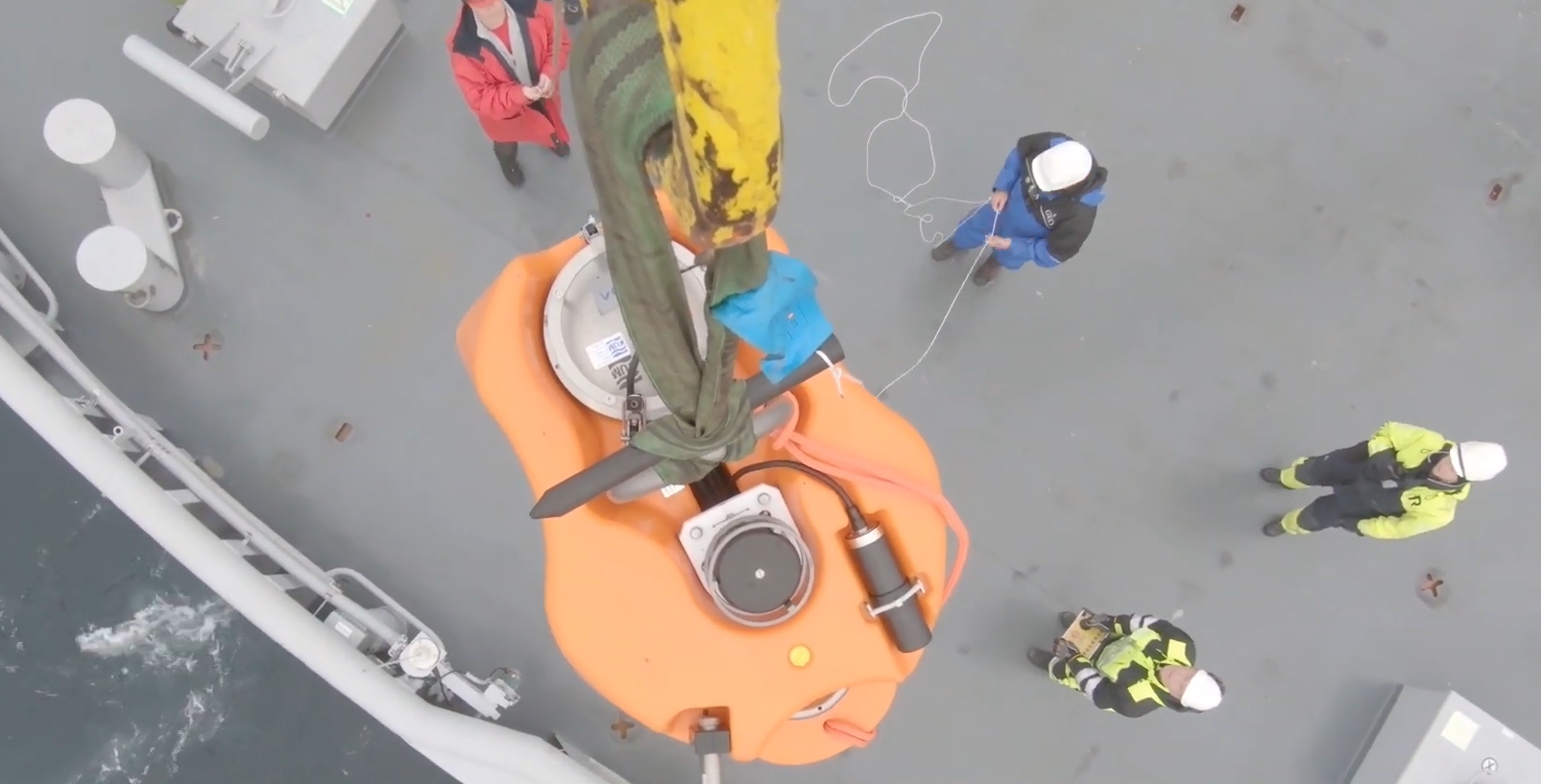
Fixed ocean moorings are the main platforms to provide long-term observations of marine environment, covering different time scales from shorter than hourly to monthly, seasonal, and multiannual measurements. Moored instruments can nearly continuously measure different ocean variables, including physical, biogeochemical, and biological parameters (and also collect samples and visual images) and are widely used in ocean research all over the world. However, mooring operations in the demanding, ice-covered polar areas are linked to unique challenges, related to both the platform design (instrumentation and mooring hardware) and to how to deploy and recover a mooring from an icebreaker in the partial or even full sea ice cover. During this short course, we will introduce the main issues about how to plan, design, equip and operate a mooring for measurements in the polar region. We will present different types of oceanographic instruments and discuss their fitness for measurements in polar waters. We will also address the specific ship operations for deployment and recovery of moorings in ice-covered waters and discuss how to ensure safe and efficient work with under-ice moored equipment.
3.2 Module 3: Supporting reading material.
Lee et al., 2019. A framework for the development, design and implementation of a sustained arctic ocean observing system. Front. Mar. Sci. 6:451. doi: 10.3389/fmars.2019.00451.
Beszczynska-Möller et al. 2011. A synthesis of exchanges through the main oceanic gateways to the Arctic Ocean. TOS Oceanography, 24(3): 82–99, doi: 10.5670/oceanog.2011.59.
Complete reading list.
3.3 Module 3: Self-evaluation module.
Test your knowledge by completing this self-evaluation quiz.
4. E-Learning Module 4 - Snow and Sea Ice
Contributor: Roberta Pirazzini, Anna Kontu, Henna-Reetta Hannula, FMI, Bin Cheng, FMI.
Learning objectives: This package introduces the Lapland field station, Sodankylä, and its role in monitoring the terrestrial Arctic snow, as well as looking at the role of drones in the study of sea ice. Learners will gain an appreciation of the cutting edge technologies applied in the field, and learn new approaches to Arctic data analysis.
Target Audience: Undergraduate and graduate students in the field of polar atmospheric and terrestrial science, as well as for research infrastructure managers and data users (above all modellers).
Content of the Package:
1. Tutorial: Sodankylä supersite: Interdisciplinary, multisensory and multispectral observations of Arctic atmosphere, snow, and land.
2. Tutorial: Drone-based albedo measurements at the North Pole.
3. Tutorial: Sea ice thermodynamics.
4. Supporting reading material.
4. Self-evaluation module.
4.1 Tutorial: Sodankylä supersite: Interdisciplinary, multisensory and multispectral observations of Arctic atmosphere, snow, and land.
The presentation describes the observational supersite of Sodankylä, in northern Finland, comprising a network of distributed observational towers and sensors in forest wetland, open fields, covering an area of few square kilometres. The major instruments will be illustrated, together with the obtained physical parameters and their application areas.
4.2 Tutorial: Drone-based albedo measurements at the North Pole.
Drone-based albedo and photo-mosaic observations over Arctic sea ice were carried out during the last leg of the MOSAiC experiment (August-September 2020). These albedo observations were the northernmost ever made from drone and complemented the surface-based albedo observations carried out over the drifting ice floe from fixed and portable instruments. The combination of drone based-albedo and photo-mosaic observations will enable the evaluation of albedo variability over different spatial scales (from m to 100m) in an environment characterized by high albedo heterogeneity and strong albedo contrasts between the different surface types (first-year ice, multi-year ice, melt ponds, open leads). The presentation will illustrate the measurement platforms, the performed flights, the encountered sea ice conditions and will introduce the scientific objectives of the planned data analysis.
4.3 Tutorial: Sea Ice Thermodynamics
Discover the practical and applied aspects of sea ice thermodynamics. Prepare for your expedition to the Arctic field station. Know which parameters to collect and how to use them once you are back from the field, as a model applicant or as a model developer. Learn about sea ice mass balance, measurements, modelling and more.
4.4. Module 4: Supporting reading material.
Snow Albedo:
Dai et al. (2019). Arctic amplification is caused by sea-ice loss under increasing CO2. Nat Commun, 10(1), 121. doi: 10.1038/s41467-018-07954-9
Thackeray and Hall (2019). An emergent constraint on future Arctic sea-ice albedo feedback. Nature Climate Change, 9(12), 972-978.
Perovich et al. (2002). Seasonal evolution of the albedo of multiyear Arctic sea ice. Journal of Geophysical Research, 107(C10). doi: 10.1029/2000jc000438
Light et al. (2015). Optical properties ofmelting first-year Arctic sea ice. Journal of Geophysical Research: Oceans, 120, 7657–7675. doi: doi:10.1002/2015JC011163
Wiscombe and Warren (1980). A Model for the Spectral Albedo of Snow I: Pure Snow. Journal of the Atmospheric Sciences, 37, 2712-2733.
Calonne et al. (2014). Study of a temperature gradient metamorphism of snow from 3-D images: time evolution of microstructures, physical properties and their associated anisotropy. The Cryosphere, 8(6), 2255-2274. doi: 10.5194/tc-8-2255-2014
Sea Ice Thermodynamics:
Eicken et al. (2014). Field Techniques in Sea-Ice Research in Cold Regions Science and Marine Technology, [Ed. H. Shen], in Encyclopedia of Life Support Systems (EOLSS), Developed under the Auspices of the UNESCO, Eolss Publishers, Paris, France.
Leppäranta (Ed.) (1998). Physics of ice-covered seas Vol.1 and 2, Edited by Matti Helsinki University Printing House, Helsinki, 1998, Report Series in Geophysics, 28. Access here: Vol1, Vol2.
Leppäranta (1993) A review of analytical models of sea‐ice growth, Atmosphere-Ocean, 31:1, 123-138, DOI: 10.1080/07055900.1993.9649465
Cheng and Launiainen (1998). A one-dimensional thermodynamic air-ice-water model: technical and algorithm description report. In: Meri-Report Series of the Finnish Institute of Marine Research. No. 37: 15-35.
Liao et al. (2019). “Snow depth and ice thickness derived from SIMBA ice mass balance buoy data using an automated algorithm” International Journal of Digital Earth, 12:8, 962-979, DOI: 10.1080/17538947.2018.1545877
Cheng et al. (2020). Air/snow, snow/ice and ice/water interfaces detection from high-resolution vertical temperature profiles measured by ice mass-balance buoys on an Arctic lake. Annals of Glaciology 1–11. DOI: https://doi.org/10.1017/aog.2020.51
4.4a. Module 4: Self-evaluation module: Snow albedo.
Test your knowledge by completing this self-evaluation quiz.
4.4b Module 4: Self-evaluation module: Sea ice thermodynamics.
Test your knowledge by completing this self-evaluation quiz.